

Description
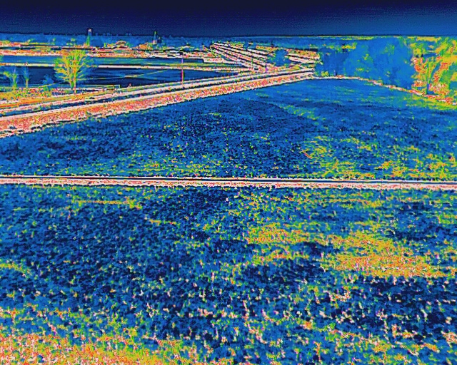
Orthomosaic Mapping stitches hundreds of precision-geotagged aerial photos into one seamless, true-scale map of your site. Every pixel is measured, leveled, and corrected for perspective, so you can zoom in, inspect conditions, and take accurate distances, areas, and counts. Using RTK flight plans, we typically deliver 1–3 cm/pixel ground sampling—ideal for roof documentation, construction progress, asset audits, and insurance reporting. Deliverables include a georeferenced orthophoto (GeoTIFF/PNG), web map viewer for easy sharing, CAD/KML overlays, and optional DSM/3D models with annotations and measurement reports. In plain terms: you get a current, high-resolution “single source of truth” image of the property that’s easy to view, easy to share, and reliable for decision-making.
Reviews
There are no reviews yet.